Tuesday, April 11, 2017

MINING


Environmental effects: changes to the land, on the surface and underground, pollution, destruction of the natural space.
MINING AND INDUSTRIAL AREAS
UNITE CONTENTS
1.- Raw material:

RAW MATERIALS
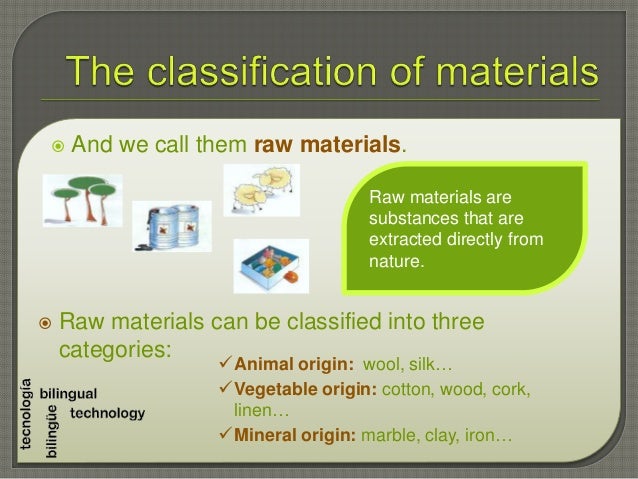
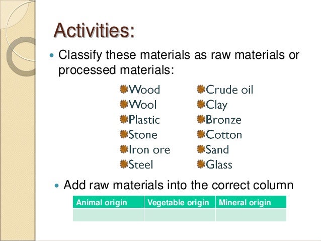
1.- Raw material:
- Definition
- Origin
- Classification
- Definition
- Environmental effect.
- Definition
- Types: renewable /non-renewable; traditional /alternatives
- Definition
- Historical developmen: First Industrial Revolution, Second Industrial Revolution, Information and Automation Revolution.
- Classification of industries: Base industries, capital goods industries, consumer goods industries.
- Factors for industrial location: Traditional factors/ current factors.
- Great industrial areas in the world.
RAW MATERIALS
Tuesday, March 14, 2017
AGRICULTURAL LANDSCAPE
Agricultural landscape is created when people modify natural areas in order to use them for crop agriculture, livestock farming or forestry.


It can be influenced by physical and human factors.
PHYSICAL FACTORS:
- Climate: temperatures and rainfall
- Relief: Sunny and shady sides of the mountains, incline of slopes, altitude.
- Soil: the more appropriate nutrients the soild has, the better it is for agriculture.
Plants need minimun temperatures (10ºC) and rainfall (between 900 and 1200 mm annually to grow)

Flat surfaces facilitate agricultural work and very steeps slopes make it more difficult.
Deep soil is more appropriate for the cultivation of most crops because roots have more space to expand.
THE PRIMARY SECTOR
The primary sector consists of economic activities that obtain resources
from nature. Those activities are: agriculture, livestock, forestry,
fishing and mining.

Sunday, February 19, 2017

Friday, February 17, 2017

PRODUCTS AND SERVICES
Products are goods obtained directly form nature or that have been turned into something.


Services are activities carried out by humans to benefit society.


Services are activities carried out by humans to benefit society.

ECONOMIC ACTIVITY

Sunday, February 12, 2017
ASIA
Asia is the largest of the world's continents, covering approximately 30% of the Earth's land area.
It is also the world's most populous continent, with roughly 60% of the total population.
Asia makes up the eastern portion of the Eurasian supercontinent; Europe occupies the western portion. The border between the two continents is debated. However, most geographers define Asia's western border as an indirect line that follows the Ural Mountains, the Caucasus Mountains, the Caspian and the Black Seas. Asia is bordered by the Arctic, Pacific and Indian Oceans.

Thursday, January 12, 2017
VIDEO OF AFRICA: ACTIVITIES
ANSWER THE
FOLLOWING QUESTIONS
- Where in the world is Africa?
- How many times is Africa larger than The United States?
- How is the savanna defined in the video?
- Which animals can be found in the savanna biome?
- Where is located the chaparral biome in Africa?
- Which are the most famous deserts in Africa?
- The main natural resources mentioned in the video are .....
FIND THE MISSING
WORDS
1.
Africa
runs 5 000 miles from the Mediterranean sea all the way down to ……………………………………………..
and 4 600 miles from ………………………………… all the way over to …………………………………………………
2.
Biomes
are climate zones and throughout that area, throughout that …………………………, you can
see the same average ……………………………………. and average ……………………………….. what that means
is that you also see very similar ………………………………………………………………living in that
region.
3.
The
most famous desert in Africa is, of course, the Sahara desert. Now, some parts
of the Sahara desert are ……………………………., like you can see here. Other parts of the
Sahara desert are …………………………….. but in either case, the fact that it is very ………………
is going to make it a very difficult …………………………….. to cross.
4.
It
is not the …………….. itself that’s particularly
important, it’s also the ………………………………… There are many different ………………………………………………….
…………. That can be found in the ………………………………..
and that’s one of the thing that
makes the rain forest so ………………………… not just in Africa but throughout the
Earth.
5.
The
………………………………….is the most famous river in Africa, because is the …………………………
river in the world. But there is also the ……………………………………………….. which is the ………………………………….. longest river in the world.
6.
Africa
actually has its own version of the …………………………………….. with famous lakes like
Lake ……………………, lake ………………………………. and lake …………………………………………….
7.
All
the Africa is a plateau. Meaning that Africa itself is an ……………………………………..
land. But that doesn’t mean you can’t find any
……………………………………. in Africa. You can find mountain ranges like, for
example, the ………………………………………………………. in northwestern Africa.
8.
Africa
also has some interesting mountains like …………………………………………. , the highest …………………..
in Africa which seems to just ……………………. on it own out of the ………………………………..
9.
The
Great Rift Valley refers to a region of Africa that is literally, being …………………………. apart. There are
some ………………………………………………….that are located within or near Africa, that are,
actually, ………………….. away from each other, and what’s doing is creating not just
some of the highest ……………………………….. in Africa, but also lakes like ……………………………………..
that is among the ……………………………. in the world.
Sunday, January 08, 2017
SECOND TERM
CONTENTS:
In this video you can see some of the most important features of Africa. Try to understand it because you will have to answer some questions based on the information it is giving you.
- Physical and political Geography of Africa and Asia
- The State political organization
- How the Economy works
- Primary and secondary Economic sectors.
Sunday, December 18, 2016
PULL AND PUSH FACTORS WORKSHEETS
As you can see, our textbook has not much information about migration. So, here there is some extra information and activities for you to learn more about why people decide to leave their home country.
MIGRATION: PULL AND PUSH FACTORS.
In the next video you can see some images showing some migration factors. Could you classify them by pull and push factors.MIGRATIONS: PULL AND PUSH FACTORS on PhotoPeach
Saturday, December 17, 2016
USA BIG CITIES
One of the consequences of population growth is the development of cities.
Watch this video and answer the questions.
Friday, November 25, 2016

POPULATION DENSITY
Why do people choose to live in some places and not in others?
In the next tables you can find some reasons for explaning people's distribution.

In the next tables you can find some reasons for explaning people's distribution.
|
PHYSICAL
|
||||
|
|
Densely populated
|
Examples
|
Sparsely populated
|
Examples
|
|
Relief
|
Flat plains and low-lying undulating
areas
|
Bangladesh
|
High, rugged mountains
|
Andes
|
|
Broad river valleys
|
Ganges Valley
|
Worn-down shield lands
|
Canadian Shield
|
|
|
Foot hills of active volcanoes
|
Etna, Pinatubo
|
|
|
|
|
Climate
|
Evenly distributed rainfall
with no temperatures extremes
|
North-west Europe
|
Limited annual rainfall
|
Sahara Desert
|
|
Areas with:
1.high sunshine totals
2.heavy snowfall for tourism
|
1.Spanish coast
|
Low annual temperatures
|
Greenland
|
|
|
2.-Swiss alpine valleys
|
High annual humidity
|
Amazon rainforest
|
||
|
Seasonal monsoon rainfall.
|
Bangladesh
|
Unreliable seasonal rainfall
|
Sahel
|
|
|
Vegetation
|
Grassland (ease to clear/farm)
|
Paris Basin
|
Forest
|
Amazonia, Canadial Shield
|
|
Soil
|
Deep fertile silt left by
rivers
|
Nile Valley and Delta
|
Thin soils in mountainous or
glaciated areas.
|
Northern Scandinavia
|
|
Volcanic soils
|
Etna
|
1.Laking humus
2.affected by leaching
|
1.Sahel
2.Rainforest
|
|
|
Natural resources
|
Mineral, e.g. coal, iron ore
|
Pennsylvania, Johannesburg
|
Lacking minerals
|
Ethiopia
|
|
Energy supplies, e.g. HEP
|
Rhône Valley
|
Lacking energy supplies
|
North-east Brazil
|
|
|
Water supply
|
Reliable supplies
|
North-west Europe
|
Unreliable supplies
|
Afganistan
|
|
Natural routes
|
Gaps through mountains,
confluence of valleys.
|
Rhine Valley, Paris
|
Mountain barrier
|
Himalayas
|
|
HUMAN
|
||||
|
|
Densely populated
|
Examples
|
Sparsely populated
|
Examples
|
|
Economic
|
Ports
|
New
York, Sydney
|
Limited
facilities for ports
|
Bangladesh
|
|
Good
roads, railways, airports
|
Germany,
California
|
Poor
transport links
|
Himalayas
|
|
|
Industrial
areas (traditional)
|
Pittsburgh,
Ruhr
|
Lack
of tourist development
|
Sudan
|
|
|
Development
of tourism
|
Banff(Canada),
Jamaica
|
Lack
of tourist developments
|
Iraq
|
|
|
Money
available for new high-tech industries.
|
California,
south of France
|
Lack
of government investment
|
Nepal,
Gaza
|
|
|
Political
|
Government
investment
|
Tokyo
region, north Italy
|
Lack
of government investment
|
Dem.
Rep. of Congo
|
|
New
towns
|
Satellite
towns around Cairo, Brasilia
|
Depopulation
of rural and old industrial areas
|
North-east
Brazil, Belgian coalfield
|
|
|
Reclamation
of land
|
Hong
Kong Island, Dutch polders
|
Loss
of land, e.g. deforestation, and soil erosion
|
Amazonia,
Apennines, Sahel
|
|
|
Social
|
Better
housing opportunities
|
Arizona
|
Poor
housing opportunities
|
Afghanistan,
Soweto
|
|
Education
, health facilities, entertainment
|
Sydney,
Milan
|
Limited
education, health facilities, entertainment
|
Rwanda
|
|
|
Retirement
areas
|
Spanish
costas, Canary Islands
|
Poor
facilities for retirement
|
Eritrea
|
|

Subscribe to:
Posts (Atom)